
Philadelphia ZIP Code Areas
Philadelphia mapping materials display 48 delivery ZIP areas in the City footprint. The labels below are orientation, not a promise that a ZIP follows a neighborhood, ward, or legal boundary. Use the full address when ordering a record or checking a parcel. The City notes that its ZIP polygon edges are modified slightly for map clarity, while the Postal Service supplies the delivery answer for a particular address. That distinction matters when a Philadelphia ZIP code directory is used to narrow research about a block, a family address, or a City service.
| ZIP | Philadelphia area orientation | Delivery check | Map note |
|---|---|---|---|
| 19102 | Center City, Rittenhouse-Fitler edge | USPS exact-address lookup | City map area |
| 19103 | Center City West, Rittenhouse-Logan Square | USPS exact-address lookup | City map area |
| 19104 | University City, Mantua, Powelton, West Philadelphia | USPS exact-address lookup | Several civic areas |
| 19106 | Old City, Society Hill, Center City East | USPS exact-address lookup | City map area |
| 19107 | Chinatown, Center City East | USPS exact-address lookup | City map area |
| 19111 | Fox Chase, Lawndale, Castor Gardens | USPS exact-address lookup | Northeast orientation |
| 19112 | Navy Yard, lower South Philadelphia | USPS exact-address lookup | City map area |
| 19113 | Small Southwest, airport-adjacent area | USPS exact-address lookup | Do not infer a station |
| 19114 | Torresdale, Parkwood | USPS exact-address lookup | Far Northeast |
| 19115 | Bustleton, Somerton | USPS exact-address lookup | City map area |
| 19116 | Somerton, far Northeast | USPS exact-address lookup | City map area |
| 19118 | Chestnut Hill | USPS exact-address lookup | City map area |
| 19119 | Mount Airy | USPS exact-address lookup | City map area |
| 19120 | Olney, Feltonville | USPS exact-address lookup | City map area |
| 19121 | Strawberry Mansion, Brewerytown, north-central | USPS exact-address lookup | Several civic areas |
| 19122 | Northern Liberties, Kensington, Fairhill edge | USPS exact-address lookup | City map area |
| 19123 | Northern Liberties, Callowhill | USPS exact-address lookup | City map area |
| 19124 | Frankford, Juniata, Lawncrest | USPS exact-address lookup | City map area |
| 19125 | Fishtown, Kensington, Port Richmond edge | USPS exact-address lookup | City map area |
| 19126 | East and West Oak Lane | USPS exact-address lookup | City map area |
| 19127 | Manayunk | USPS exact-address lookup | City map area |
| 19128 | Roxborough | USPS exact-address lookup | City map area |
| 19129 | East Falls, Allegheny West | USPS exact-address lookup | City map area |
| 19130 | Fairmount, Art Museum, Center City North | USPS exact-address lookup | City map area |
| 19131 | Wynnefield, Overbrook, Haddington | USPS exact-address lookup | City map area |
| 19132 | Strawberry Mansion, Allegheny West | USPS exact-address lookup | City map area |
| 19133 | Fairhill, Kensington, north-central | USPS exact-address lookup | City map area |
| 19134 | Port Richmond, Harrowgate, lower Northeast edge | USPS exact-address lookup | City map area |
| 19135 | Tacony | USPS exact-address lookup | City map area |
| 19136 | Holmesburg, Torresdale | USPS exact-address lookup | City map area |
| 19137 | Bridesburg, riverward edge | USPS exact-address lookup | City map area |
| 19138 | West Oak Lane, Ogontz | USPS exact-address lookup | City map area |
| 19139 | Cobbs Creek, Haddington, West Philadelphia | USPS exact-address lookup | City map area |
| 19140 | Hunting Park, Nicetown-Tioga | USPS exact-address lookup | City map area |
| 19141 | Logan, Fern Rock, Ogontz edge | USPS exact-address lookup | City map area |
| 19142 | Elmwood, Southwest Philadelphia | USPS exact-address lookup | City map area |
| 19143 | Cedar Park, Kingsessing, University City edge | USPS exact-address lookup | City map area |
| 19144 | Germantown | USPS exact-address lookup | City map area |
| 19145 | West and lower South Philadelphia | USPS exact-address lookup | City map area |
| 19146 | Graduate Hospital, Point Breeze, central South | USPS exact-address lookup | City map area |
| 19147 | Bella Vista, Queen Village, South Street | USPS exact-address lookup | City map area |
| 19148 | Whitman, Pennsport, stadium area | USPS exact-address lookup | City map area |
| 19149 | Mayfair, Oxford Circle | USPS exact-address lookup | City map area |
| 19150 | Oak Lane edge | USPS exact-address lookup | City map area |
| 19151 | Overbrook, Morris Park, West Philadelphia edge | USPS exact-address lookup | City map area |
| 19152 | Rhawnhurst, Bells Corner | USPS exact-address lookup | City map area |
| 19153 | Eastwick, airport area | USPS exact-address lookup | City map area |
| 19154 | Byberry, Parkwood, far Northeast | USPS exact-address lookup | City map area |
Neighborhood names help a researcher choose a starting area, but the Philadelphia ZIP code directory cannot turn a map zone into a resident list. For a street or parcel question, the address becomes the controlling key.
Check a Philadelphia ZIP Code
The USPS ZIP Code Lookup verifies delivery information from an address plus city and state, or from a ZIP. It is the right check before mailing a record request or comparing two versions of an address. USPS expressly warns that a ZIP result does not confirm a person or company at that address. Keep that limit in mind when a historical directory, a deed, and a current delivery record use similar but not identical address forms.
The official USPS screen is shown below. It is a delivery tool, not a Philadelphia resident lookup.
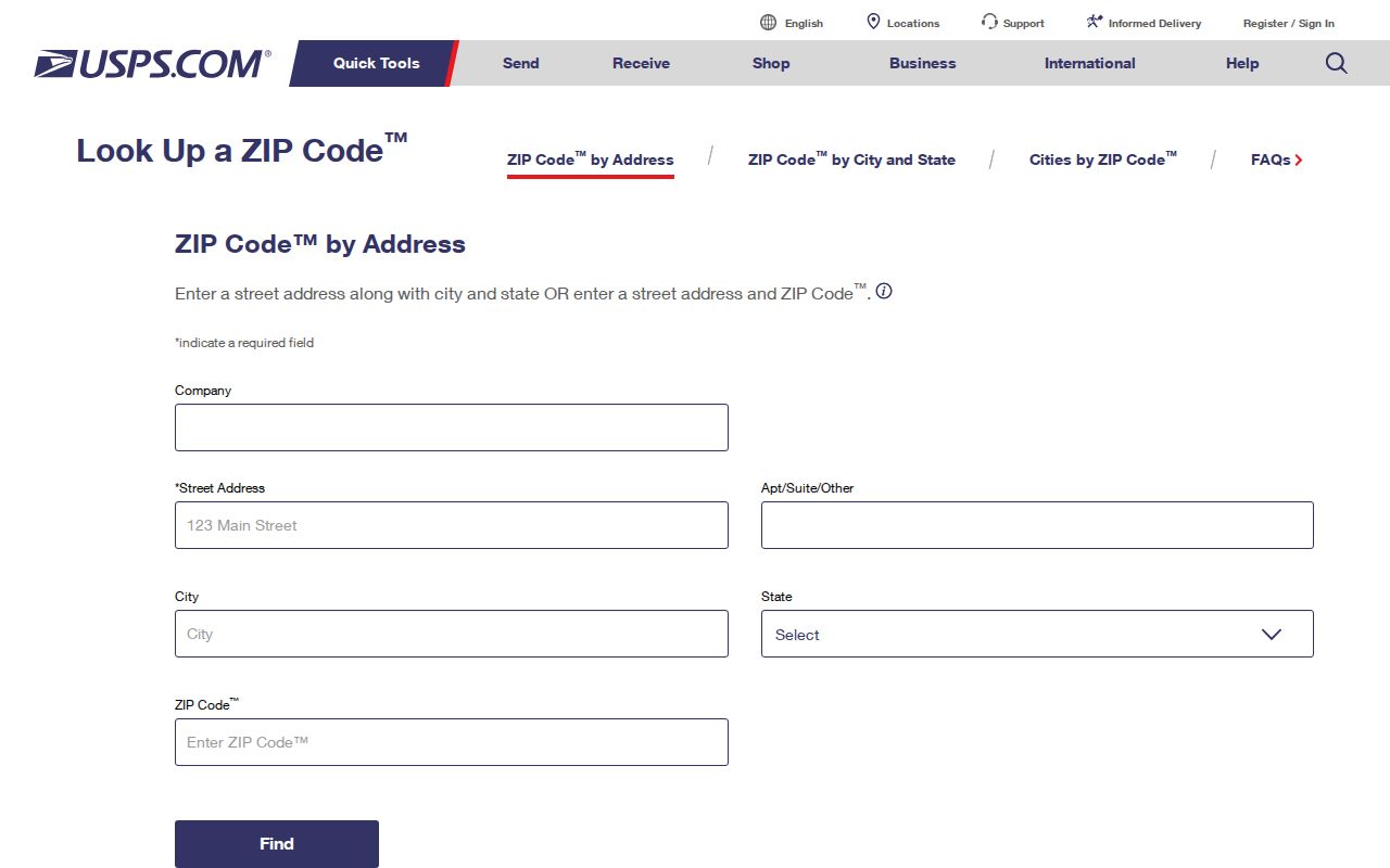
A confirmed delivery ZIP helps prevent an address error from being carried into a City search, but it does not replace the OPA account or Department of Records map number.
| USPS input | Use in Philadelphia research |
|---|---|
| Street address, city, and state | Confirm the delivery ZIP for a precise City address. |
| ZIP code | Check a delivery area, then return to the full address for local records. |
| Result | Delivery geography only; it does not confirm an occupant or organization. |
Philadelphia ZIP Code Boundaries
OpenDataPhilly ZIP polygons offer a convenient City map layer, but their boundaries are intentionally adjusted for logical and cartographic use. That means a displayed edge is useful for orientation, not for deciding whether a delivery address belongs to a particular government district. Philadelphia has 18 planning-district plans, wards and divisions, RCO boundaries, neighborhoods, parcel lines, and delivery areas. They may overlap, but they answer different questions.
Use a Philadelphia ZIP code directory to group places for practical work, such as checking an address or locating a City service. Do not use its borders to infer residence, a voting district, or property ownership. Atlas and the Property App begin from a location, not a ZIP-wide name search.
- ZIP code
- A Postal Service delivery-area label that helps route mail. It is not a City record jurisdiction.
- ZIP+4
- An added delivery segment that narrows routing within a ZIP. It does not identify a household.
- PO-box ZIP
- A ZIP used for a post-office-box delivery pattern. It should not be treated as a street-address area.
- Carrier route
- A mail-delivery grouping inside a ZIP. It is not a parcel boundary, neighborhood line, or resident roll.
Philadelphia ZIP Code Record Paths
A ZIP can help sort an address list, but Philadelphia’s core property tools do not accept a ZIP query. The Property App uses street address, OPA account number, or Department of Records registry map number. Its documented `block:` syntax, map point, 250-foot radius, and drawn-boundary tools work from a known location. The App removed owner-name search for privacy, so it cannot make a citywide owner list from a ZIP code.
- Confirm the delivery ZIP with the full Philadelphia address.
- Enter that street address in the Property App or Atlas.
- Save the OPA account and DOR map identity shown for the parcel.
- Use the parcel or address key for a deed, permit, court, or historical-record question.
Once a ZIP has narrowed an area to a specific address, the Philadelphia street directory gives the address-first record chain. A ZIP never substitutes for the parcel-level search.
Philadelphia ZIP Code Search Fields
The City’s food-safety inspection finder is a real local interface that accepts a business name, address, or ZIP. Its reports cover the past three years. This makes it a useful example of a Philadelphia ZIP code filter, but the results concern inspections and businesses, not a household directory or property-owner search.
The City’s inspection search is displayed below, with its ZIP option available alongside name and address entries.
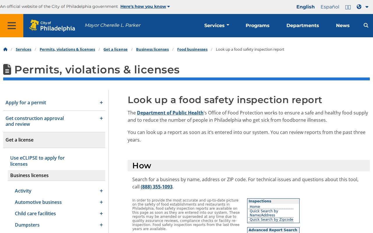
The form shows why the source matters: ZIP is an accepted filter for this inspection record, while the Property App remains address and identifier led.
| Portal | Available Philadelphia input | Result boundary |
|---|---|---|
| Food Safety finder | Business name, address, or ZIP | Recent inspection context, not a people list. |
| Property App | Address, OPA account, DOR map number, map tools | Parcel evidence, not a ZIP or owner-name search. |
| Atlas | Address, intersection, OPA account, DOR number | Mapped City-resource links for a location. |
Philadelphia Addresses Before ZIPs
Philadelphia address form can matter more than the ZIP. City engineering standards use Market Street as the usual north-south divider and Front Street as the usual east-west divider. Germantown Avenue north of Windrim and areas north of Wissahickon or Tacony/Frankford Creek have stated exceptions. Directional prefixes and hundred blocks should therefore stay in the address entered into a City portal.
For an older address, use the Historic Streets Index before assuming a ZIP or present-day number will solve the mismatch. It records historic and current name changes from City archival road sources. The 1854 consolidation and later number conversions can break a simple street-name match. Preserve the original wording, then compare it with the City’s current official address.
The Free Library’s house-history route joins directories, maps, deeds, permits, and tax material around a defined address.
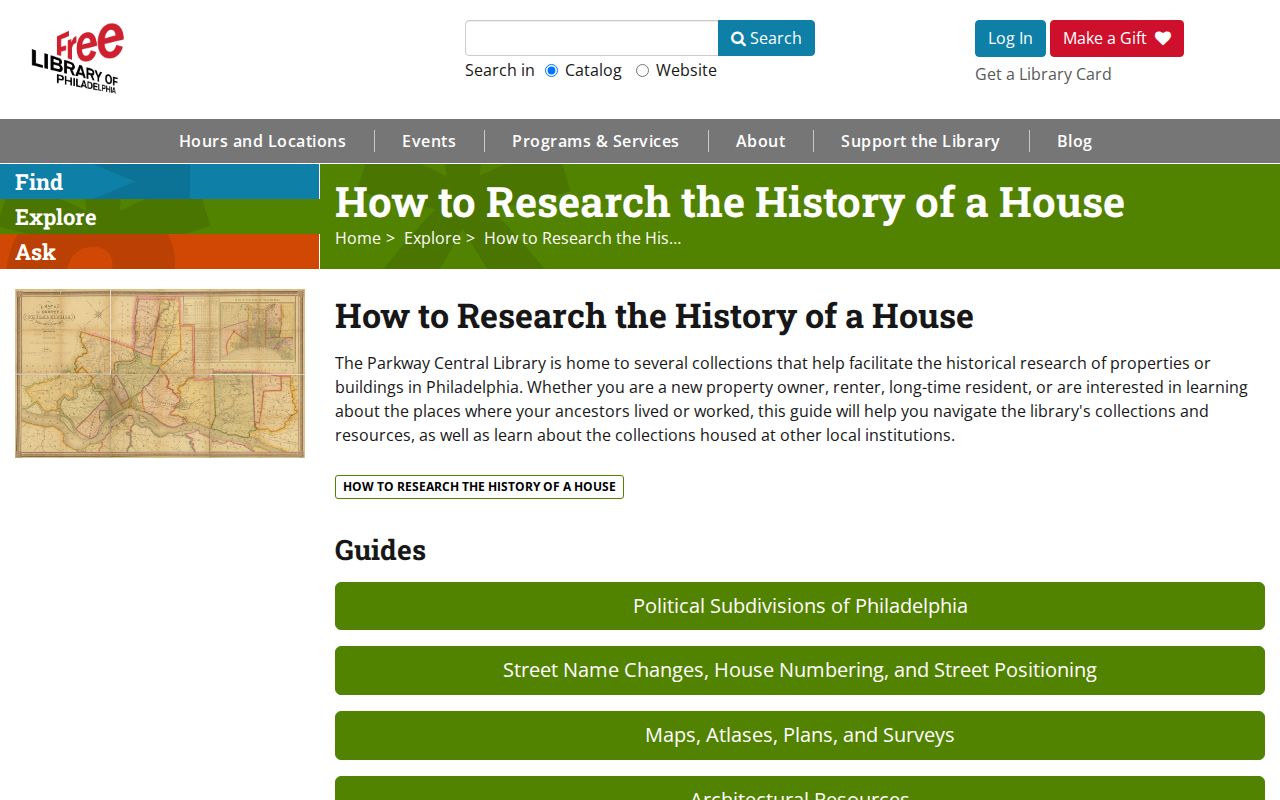
A ZIP can help orient the address, but the house-history path depends on the street form, parcel, dates, and record keeper.
Note: Keep directional letters, historic spellings, and the official base address together when comparing Philadelphia records from different years.
Philadelphia ZIP Code Civic Geography
ZIP areas do not replace the local civic geography around a Philadelphia address. The City’s Registered Community Organizations program maps approved organizations, boundaries, meeting details, and public contacts for development notice. Those materials can help a person understand which civic area touches an address, but they are not a membership or neighbor roster.
The City RCO directory is shown below. It provides a community contact layer that can cross the neighborhood labels used in a Philadelphia ZIP code directory.
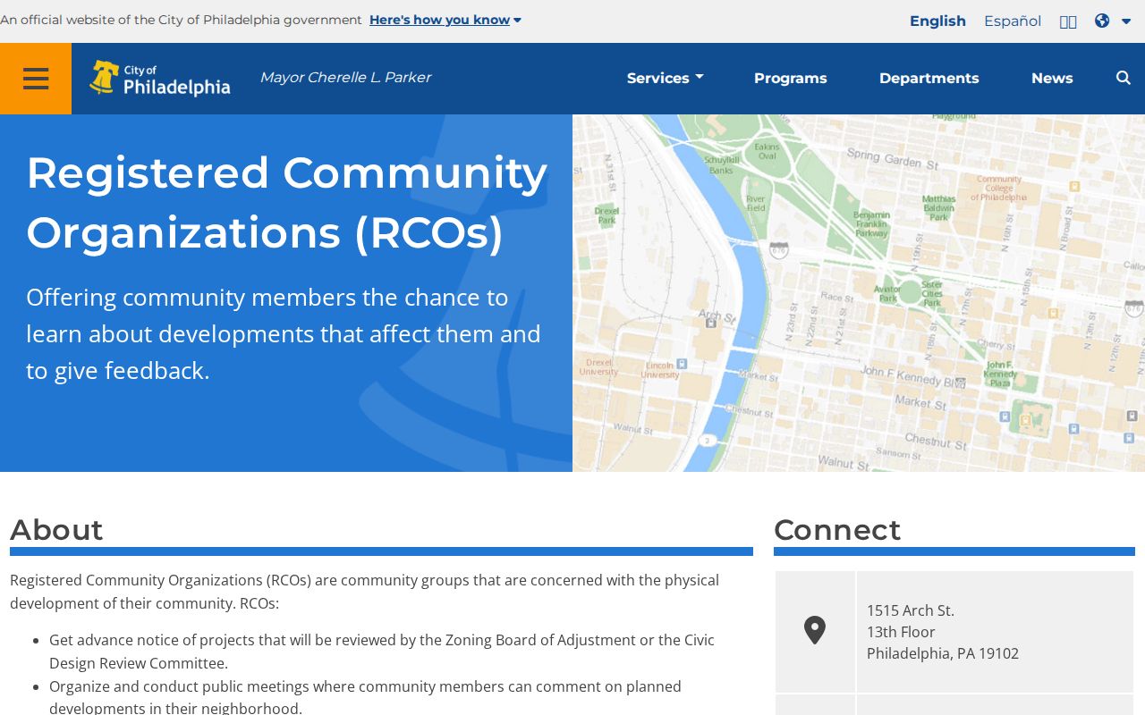
Use the boundary and meeting information to understand public civic coverage, not to decide who resides within a ZIP or on a block.
Philadelphia ZIP Code and Older Directories
ZIP codes are modern delivery labels, so an older address trail often needs a directory, street conversion, map, or deed rather than a ZIP search. City Archives lists Philadelphia city directories from 1785 to 1936, while the Free Library’s microfilm shelf includes directory runs, address telephone books, and reverse directories with gaps. A printed listing can show a name, address, and occupation for its publication period, not a full household or a current residence.
The Free Library’s digitized 1910 Philadelphia Colored Directory is one example of a historically bounded directory collection. For a historic address, it belongs in a date-specific research trail and should be paired with a records custodian when a fact needs verification.
Philadelphia ZIP Code Directory Limits
The Pennsylvania voter-status tool verifies an individual’s registration with identifying details, including county and ZIP context, but it is not a neighborhood browser. State voter-list products have their own certification and use limits, including a bar on Internet publication. A City parcel card, a postal result, a historic directory, and a voter record also have different purposes. None should be merged into an unverified statement about a person.
Philadelphia’s Address Confidentiality Program participants may use a substitute mailing address in listed records. Private utility and delivery-account data are not public records. A missing name or address can reflect a lawful privacy boundary, not an invitation to infer the person’s location from other sources.