
Philadelphia Neighbors by Parcel
Public records around a Philadelphia block are address and parcel records first. They can describe the physical parcel, its assessment history, a recorded land-document party, a permit, or a historical published listing. Each source has a narrow role. A named owner on a tax parcel is not necessarily the person who lives there, and an address on a historical directory entry does not prove the whole household. Keeping those boundaries clear makes a neighbor question more accurate and safer.
| Philadelphia source | What it can show about a block | Access boundary |
|---|---|---|
| Property App | Selected parcels, ownership-related fields, sales, value, and characteristics | Address, account, DOR map number, map tools; no owner-name browse. |
| Atlas | Parcel context plus map links to permits, zoning, records, and nearby City activity | Address or mapped location, not a people directory. |
| Philadox and City Archives | Document parties and a title sequence for a chosen parcel | Modern index and archival channels have different coverage. |
| Voter Street List | Controlled registration fields under State rules | Requested product with certification and publication limits. |
| Reverse directories | Historical listed names by street number | Library collection with coverage gaps and publisher lag. |
For Philadelphia neighbors, the strongest approach is to state precisely what a record establishes. Parcel ownership is parcel evidence. A directory is a dated listing. Neither supports guessing about unlisted household members.
Map a Philadelphia Neighbors Block
The Philadelphia Property App provides the documented block method: enter `block:` before a street address, choose a property on the map, use a 250-foot radius, or draw a boundary. Those controls return a finite group of parcels. The nearby set should be read one record at a time. The App accepts an address, OPA account number, or Department of Records map-registry number, and it removed owner-name searching for privacy.
- Start with the official Philadelphia street address and save the OPA account or DOR map identity.
- Use a block, radius, or drawn selection only for the immediate parcel group needed.
- Open each parcel card and preserve its address, listed property facts, sale field, and owner field as displayed.
- Open Atlas to inspect parcel placement and links to City record categories.
- Check a dated deed, permit, or directory only when it answers the specific question about that property.
Philadelphia’s drawn-boundary query is limited to fewer than 200 results, which is useful for keeping a block question finite. A block tool, radius, or map shape should be chosen to match the physical question, not used to collect a broad neighborhood list. Record the exact control used and the date of the search. A parcel can change through subdivision, consolidation, or address renumbering, so the OPA account, DOR map identity, and map position are stronger joining keys than a nearby street number alone.
When a neighboring parcel needs a dated City event, L&I Property History accepts a property address for permits, licenses, violations, and appeals. A result may name an applicant, contractor, owner, or organization rather than a resident. City Archives holds permits and plans from 1889 to 1986, with no index for 1889 to 1905, while Atlas is the documented route for 2006 and later material. Preserve the record type and date instead of turning a permit entry into a household claim.
This process runs from address to parcel to source, not from a name to a citywide list. For a full named street, the Philadelphia street directory follows the longer address trail.
Note: The Property App’s mapped block tools identify nearby parcels, not every person who lives near the selected address.
Philadelphia Neighbors Records Compared
Official sources carry a stated custodian, access channel, and record purpose. A commercial neighbor-search category can combine old or mismatched data without showing how a conclusion was reached. The better comparison is not a contest between lists. It is a decision about what fact needs checking, then a visit to the custodian that maintains that particular record.
| Question | Philadelphia record route | What not to infer |
|---|---|---|
| Which parcel is next to this address? | Property App or Atlas map context | That all nearby people are shown. |
| Who was a party to a transfer? | Philadox or City Archives deed channel | That the party currently occupies the property. |
| Who was listed at an address years ago? | Free Library reverse or city directory collection | That every occupant was listed or remains there. |
| Which civic group covers an area? | City RCO map and accepted-list contact | That the group publishes a member roster. |
A current parcel card can list an owner mailing address separately from the situs, or property, address. The situs identifies the land and improvements. A mailing address is correspondence. Retain that distinction instead of treating either one as proof of who is home.
Philadelphia Neighbors and Voter Data
Pennsylvania’s individual registration-status form is for a person checking their own registration and uses identifying fields, including first name, last name, date of birth, county, and ZIP context. It is not a browseable neighborhood directory. Philadelphia’s City Commissioners administer voter registration and elections, but the public status route remains an individual confirmation tool.
The State voter-list request form separately describes Public Information, Street, Walking, and Full Voter Export products. It requires requestor identity, a selection, and statutory certification. The form restricts uses and prohibits Internet publication. An active or inactive field is a dated registration-maintenance field, not evidence of current occupancy, and ballot selections are never revealed.
Philadelphia Neighbors Civic Contacts
For an area-level civic contact, the City’s Registered Community Organizations program is the appropriate public layer. RCOs have open scheduled meetings, elected leadership from members-at-large, boundaries, and accepted-list contacts for development notice. They are not membership directories. The City limits an RCO to no more than 20,000 parcels and keeps neighborhood improvement districts, special service districts, and ward committees as separate categories.
Strawberry Mansion CDC
Named in the City accepted list as an RCO example in a 19121 context. Use the program map for its current boundary and contact details.
Tacony Civic Association
A City accepted-list example tied to a 19135 context. The RCO route concerns civic notice and meetings, not a resident list.
Tasker-Morris Neighbors Association
Listed in 19145 and 19146 material. Confirm the current map boundary before treating a ZIP label as civic coverage.
Philadelphia City Planning Commission
RCO program contact: 1515 Arch Street, 13th Floor; rco@phila.gov; 215-683-4646.
Boundary and meeting information can connect a person to public civic participation without exposing who lives on a particular block.
Philadelphia Neighbors in Historic Listings
Past neighbors are usually a library and archive question. The Free Library records Cole’s Cross Reference Directory on microfilm from 1973 to 2007, arranged by street and numerical address, usually with a listed name, phone number, and length of residence. Address telephone directories cover 1927 to 1969. City directories run from 1785 through 1935 or 1936 depending on the holding description. Those sequences have gaps and often reflect the prior year.
Before searching an old address, use the Historic Streets Index and the Free Library’s 1898 or 1910 conversion tables where they apply. A former street name or number can produce a false no-result. A historic map, building permit, or deed may explain a lot change but does not identify an occupant by itself.
- Criss-cross directory
- A directory arranged by street and number, used to locate a historical listing from an address.
- Situs address
- The property’s physical address, distinct from a mailing address on a record.
- Grantor and grantee
- The parties in a recorded transfer. Their roles document the instrument, not present residence.
Philadelphia Neighbor Property Alerts
A surprising document in a block search can be a reason to verify a deed, not to contact anyone. The City’s deed and mortgage fraud service accepts reports and directs property owners to Department of Records help. Fraud Guard offers email alerts for recording activity under a supplied name, but it is an early warning tool, not title insurance or proof that a document is valid.
The City fraud-reporting service is shown below.
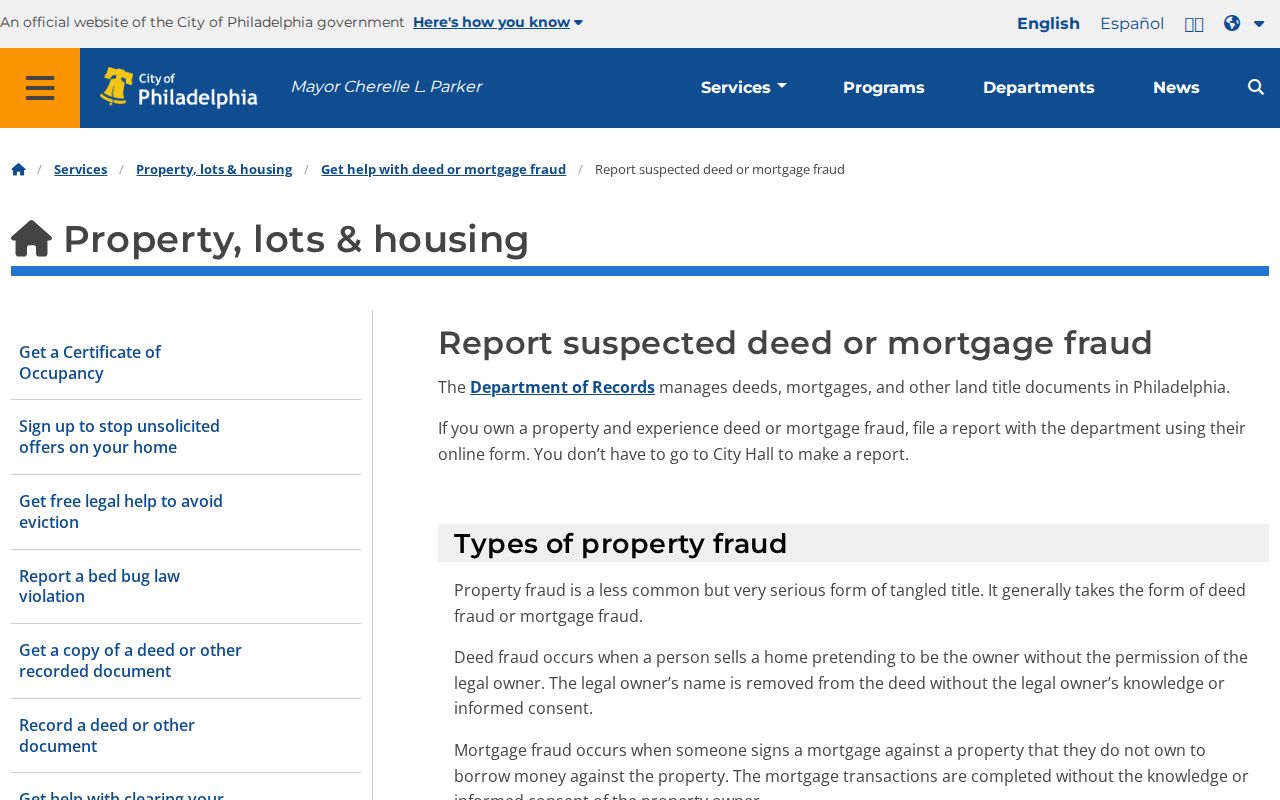
For a suspicious transfer, preserve the document reference and use the official Department of Records route. A parcel display alone is not enough to settle a title question.
Philadelphia Neighbors Privacy Limits
Some address information is properly unavailable. Pennsylvania’s Address Confidentiality Program can provide an eligible participant a substitute mailing address for listed court, vehicle, voter, school, marriage, and utility records. DMV data, private utility and delivery accounts, unlisted household members, sealed or restricted court records, and recent protected vital records do not become public merely because a parcel is nearby.
Pennsylvania’s harassment statute and stalking statute set separate limits on conduct. Public availability never authorizes repeated contact, threats, following, or acts meant to create fear. A record search should end when the official trail is protected.
The statutory sources are displayed below for their legal boundary, not as a tool for pursuing a person.
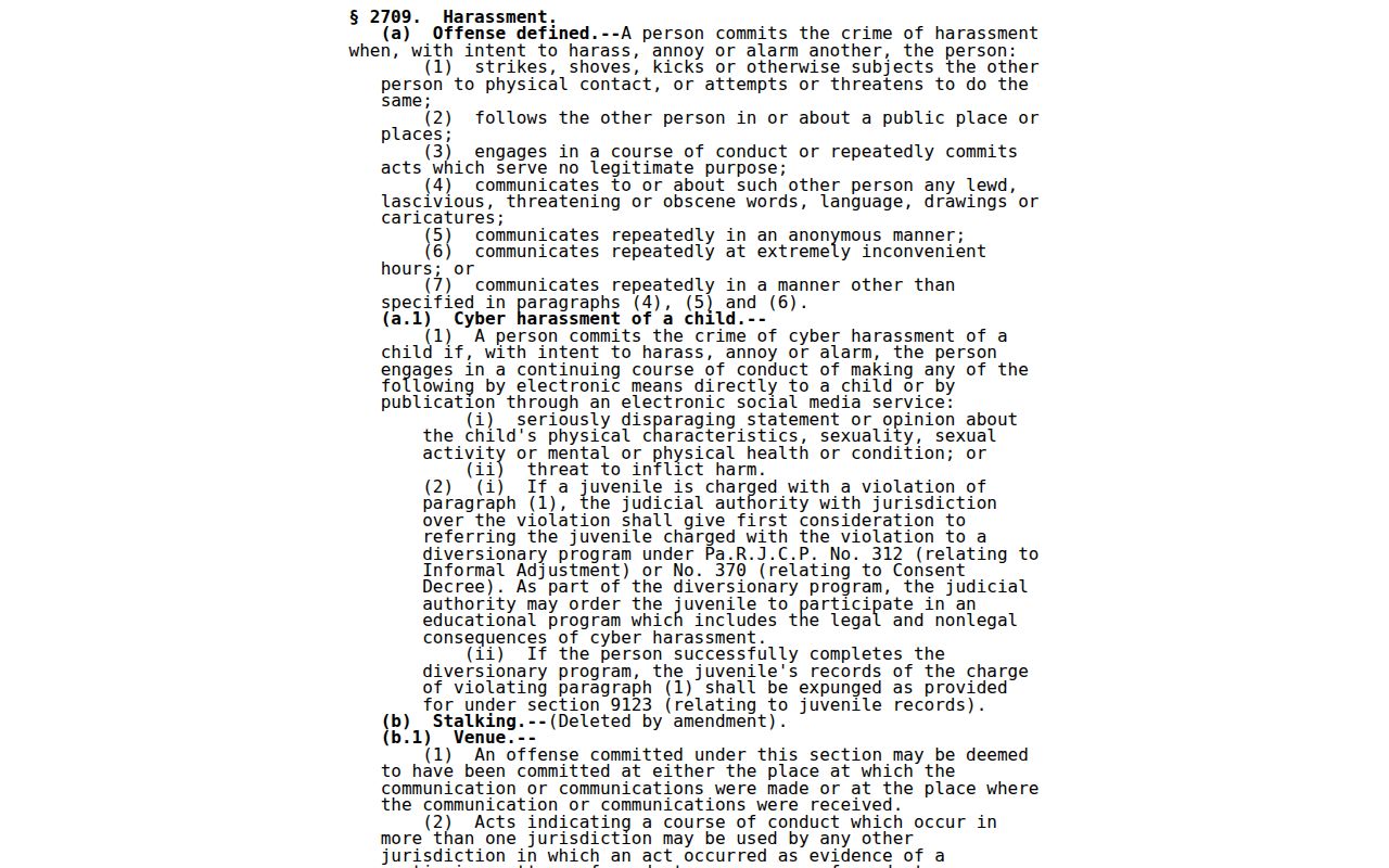
The statute reinforces that a name or address in a record must never be used to harass or intimidate someone.
The Pennsylvania stalking statute is also shown in the official legislative source below.
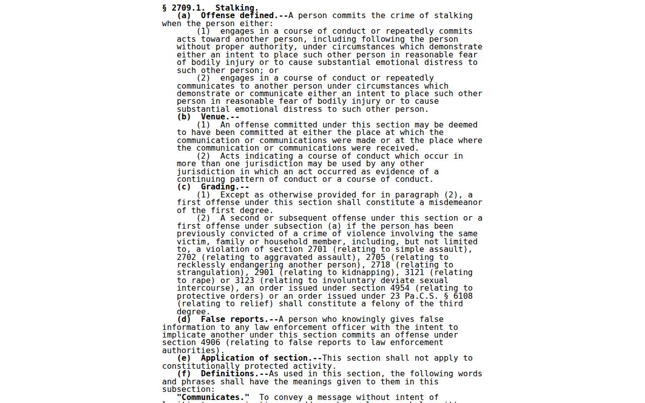
Use Philadelphia neighbors sources only for lawful personal research, family history, civic questions, or a specific record need. Do not use them to stalk, harass, or harm anyone.